
There’s recently been a bit of interest in the satellite tracking of global transportation.
Remember when we showed you a visualisation of what the flights over Africa and the world looked like? And remember I mentioned that Marine Traffic was a great app for your mobile device? Well, combining those two ideas, gives you this:
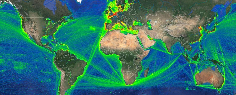
Amazing, hey? The southern hemisphere land masses look like they’re being suspended on numerous cotton threads. And you can see why we so regularly observe big ships going around Cape Agulhas.
In addition, you can see the immense importance of the Suez and Panama Canals, and the English Channel, too.
Sadly, if you want to have this global AIS-satellite data added to your current (and free) terrestrial-based Marine Traffic portfolio, it’s going to cost you upwards of €269 (R4,000) per month. Eina!